Pour la version française, c’est par ici.
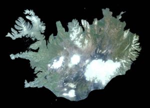
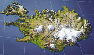
Approximately 1834 nautical miles away from Carrowteige, North-North-East, second seagull to the left then third wave on your right, lies a rather peculiar piece of rock. Straddling the mid-ocean ridge, daughter of uninterrupted underwater eruptions and endowed with a substantial geothermal activity, this place is an ever evolving island and a pure jewel of wilderness. With its landscapes blending fjords, volcanoes, mountains, desolated lunar plains, black sand beaches and other daunting visions, no wonder it has become a popular destination for tourists longing for northern visions, aurora borealis (in winter) and fields of pebbles (that’s all seasons).
ICELAND
Being a well known destination despite its climate and relative remoteness, I will not dwell on an “exhaustive” presentation of the area and every little things it has to offer. Firstly, because I’m no expert, having only been there on two occasions, but mostly because the amount of information available online would render a listing description boring and redundant. Instead, I will focus on the Laugavegur (or Laugavegurin) trail, one of the most beautiful and famous hike on the island.
But before that, a quick snapshot of Icelandic history. It introduces the subject well and similar to any other nordic territory, it is an epic tale in itself.
Sommaire
ICELAND’S HISTORY
Born from fire and lava a whooping 15 million years ago (but doesn’t seem a day older that 13 million), the island formed on a hot spot of the Mid-Atlantic ridge, between the Eurasian and North-American plates, one of the only two places in the world where the floor of an oceanic ridge reaches the surface. This separation is even directly observable in the landscape, especially in Þingvellir valley, famous for its historical ramifications. This specificity obviously tends to harbor intense geological and volcanic activity which the inhabitants learned how to take advantage, while fearing the frequent eruptions capable of paralyzing an entire continent with a gigantic ash cloud, and an unpronounceable name.
“Discovered” in the middle of the ninth century by lost Norwegian vikings, the island had presumably already been visited well before that by the Greeks a couple of centuries before Buddy Christ, as well as by Irish monks (who certainly didn’t know where they were either). The insularity of the place was determined by the Swedish viking Garðar Svavarson who decided to settle a small colony called Húsavík in a sheltered fjord of the north-west, colony that still exists as a city nowadays. Fun fact, when Svavarson decided to leave this god forsaken place, he left behind an escaped slave who became the first official inhabitant of Iceland (the story doesn’t say how long he survived). In the end, the island got its name after the visit of a third Norwegian, Flóki Vilgerðarson, who got so cold that he decided to call the place Ice Land. Could have been more original but hey.
The real colonization begins in the Xth century, mostly by south-western Norwegians under the form of disparate communities, each with their own laws and cultures. Several leaders realized then how lit it would be to put a little order in this clusterfuck and promptly declared the Free Icelandic State in 930. The world’s first parliament, the Alþing, is then set up in Þingvellir, and so begins the age of the Sagas, where the Icelandic Vikings begins to sail, explore and plunder the surroundings, bringing peace and prosperity to the youg nation. For now…
That’s it for the foundation. The following centuries can be summarized as a happy mess that saw the first independent Iceland being evangelized, passing under Norwegian yoke around 1262, then Danish in 1536, all the while sinking deeper and deeper into poverty. Much later, in 1918, Iceland finally achieved independence, while maintaining a “partnership” with Denmark. At last, on June 17, 1944, the republic of Iceland becomes a real and complete independent country. Whew.
A little side note on the language. Icelandic comes from the Old-Norse, the language spoken in Scandinavia during the Viking era which gave birth to the Danish, Swedish and Norwegian languages. Unlike those countries, and because of its isolation, this language has evolved very little in Iceland over the centuries, and the Danish occupation has had virtually no effect on it, which explains why Icelandic retains the original Norse alphabet even though it faded away in the other Scandinavian countries. Furthermore, since the XVIIIth century, local authorities maintain a certain “language purity” policy by creating new words adapted to the modern world without resorting to foreign words borrowing. Icelanders now speak a language extremely close to the one their distant Viking ancestors were practicing, and that’s pretty neat. Fortunately for tourists, English is taught at an early age, and you won’t have to binge read all the sagas just to order a beer.
Nowadays Iceland is therefore a country with a strong economy, although the 2008 crisis left its scars, with high living standards and personal development, similarly to many nordic countries. Devoid of an army, but holding strong geopolitical awareness (they initiated three “Cod wars”, forcing the United Kingdom to escort their fishing boats with warships..), its location was crucial for the allies during World War II and is now a member of NATO, the UN and the Council of Europe, despite having withdrawn its candidacy to join the EU (Fishing quota reasons. Don’t stand between an Icelandic and its goddamn fish !). In short, the island economy is mainly based on fishing, the aluminum industry, and of course, tourism.
On that note, Iceland offers marvelous landscapes, sometimes a little hard to access, but there is really something for everyone. The famous “Golden Circle” including Þingvellir National Park, Gullfos Falls and Geysir (from which geysers are named) remains the easiest tourist entry point and will content families and travelers in a rush all alike. The northwestern fjords and the northern part of the country are already a step higher but are perfect for (road/bike/horse car)-trips or a paradise for water freezing surfing enthusiasts. Finally, the country’s outback with its infinite sand roads, glaciers and schizophrenic climate represent the pinnacle of the Icelandic experience for any seasoned or rookie hiker (but you should at least be able to read a map and weather forecasts. Which leads us to the second part of this text:
THE LAUGAVEGUR
The specific hike I am going to develop here is the famous Laugavegur, or Laugavegurinn (the hot spring road), a 54 kilometers (33,5 miles) walk that can be achieved in three or four stops and connecting Landmannalaugar to Þórsmörk Valley. An additional day can be added to reach Skógar on the shore that I will present in the bonus part. This trail can be hiked in any direction, but a departure from Landmannalaugar allows for a negative elevation during most of the walk. A start in Þórsmörk on the other hand permits to discover each day a landscape more beautiful than the last, but comes with the price of knee-breaking climbs. The choice is yours.
This is one of the most famous hike in Iceland for good reasons. Neither too short nor too long, it allows to witness absolutely out of this world sceneries, sprinkled with hot springs spewing boiling steam allowing for some oasis of life along the way. Relatively easy, especially starting from Landmannalaugar, the stopover are short enough to keep some time and energy to explore the sites surrounding the refuges and discover some of the most beautiful views that can easily be overlooked. Lastly, the path is easy to follow, well maintained and has several dirt-roads access in case of mishaps.
Even if this walk can’t be qualified as a hiker’s highway, its many qualities leads to a fairly high summer attendance, with all the hassles that can come with that fact. Refuges can be fully booked months before the trail opens, and as for the campsites, you can easily find yourself in a small tent village with not-that-discreet neighbors (I do hope that Ragnar finally managed to cure is ‘effing cough), but it’s not Burning Man either, and these minor inconveniences are far from spoiling the experience, although earplugs can always be useful.
Another troublesome factor might be the weather. On that matter, this can be a Russian roulette situation as weather conditions are constantly changing and forecasts, even for the next 24h are far from reliable. In addition to the rain, unpleasant but not that bad, conditions can deteriorate rapidly with fog, strong winds, storms and even blizzards, in which case it is possible to get stuck in a refuge if you didn’t bring a GPS. And even then, you’d have to be hella motived to walk 15 kilometers whipped by snow in a grey wall of clouds.
Regarding orientation, you will find on this website a very nice online map (as well as many more information). You can also click on my itinerary titles to get some personnel annotations, done in a very professional way.
In any case, it is always better to plan for some extra days on this hike (which is easier when you did not book beds in the refuges). In case of crappy weather, it is then possible to wait for the conditions to improve before jumping in, even if you have to spend an additional night on the spot. A good schedule is to plan around ten days in Iceland, counting five days of walking. If all goes well, this will give you a couple of days to discover some other corners of the island including transportation, and if the weather gets mad, it leaves a good safety margin on the walk.
After this gigantic introduction, let’s dive more into the subject matter. What I will present below concerns my own experience and can easily be adapted to your own pace and will. I took it very easy and the weather’s gods were in my favor, but of course all of this is purely indicative. Results are not guaranteed, terms and conditions can apply.
Getting started : Reykjavik – Landmannalaugar
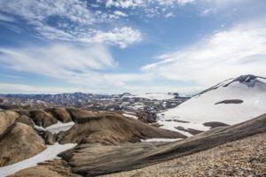
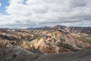
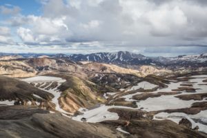
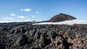
The hike begins in the Landmannalaugar highlands, a relic of intense acid volcanic activity, painting the landscapes with ocher, yellow, red and blue hues surrounding a lava field from which rise some fumaroles fed by the underground geothermal activity. Basically, this is simply one of the most magnificent regions of Iceland, pretty good achievement regarding the competition.
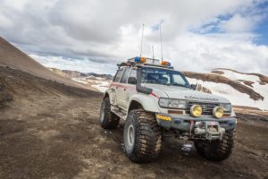
The easiest choice to reach the site is bus transportation from Reykjavik. Several local companies offer this service, allowing you to be shaken upside-down in a four wheeler bus on the worst dirt tracks to ever earn the title of “roads”. Oh yeah, FYI, because of climate (and volcanic activity), the only entirely paved road is the number 1, circling the island. It is not uncommon to encounter a dirt track after a few kilometers away from it, pretty okay at first, but quickly turning into a rental car death trap.
I would advise for an early departure from Reykjavik (around 0730-0800 AM) allowing for an early afternoon arrival on site. In that case, you have two options: Either start the walk directly up to the first refuge, Hrafntinnusker, a dozen kilometers away, or use the afternoon to dig deeper into Landmannalaugar and its wonderful sights. Be aware that these small hikes, mapped in a short guide buyable at the reception, might be quite busy with tourists visiting for the day.
Nevertheless, I recommend spending at least one night in this magical place. It is indeed one of the most beautiful places in Iceland, and leaving in a rush would be a shame. The most astonishing one is the hike to the summit of Bláhnúkur, a sleeping volcano culminating at 940 meters : A 500m elevation and six kilometers long walk that will leave you in awe. The hike will allow you to overlook the lava field and the surrounding “hills”, revealing their multicolored slopes in the afternoon light (if you are in luck).
At the end of the day, it will now be time to enjoy the local hot spring heating a small pond right next to camp. The place is busy, and it can be hard to leave the water once submerged, but I have rarely experienced such a moment of relaxation, eyes on a fabulous landscape sprinkled with snow patches, and the butt in a 50°C water.
Did you sleep well? Good, because now is the time to gain some altitude and we’re not here to warm our butt in a perfectly warmed pool. This first part is not very long, but it is the only one with a significant positive elevation, located on the first six kilometers. If you followed my advices regarding the short hikes the day before, the trail starts on the same path as many of them: The crossing of the Laugahraun lava field, then goes up next to Brennisteinsalda (which Wikipedia classifies as a rhyolitic peak for you geology geeks). On your way up there, you’ll notice pretty greenish colors on the nearby slopes, with a cute little lake just below.
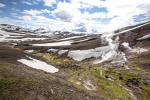
The passes crosses then a plateau with everlasting snowfields, jumping up and down once the geothermal area of Storihver is reached. This is the spot where you can get close to those big gurgling holes spitting boiling water on the black sand (and the reckless hiker’s face).
The slope then climbs a little while arriving to a pass where you will notice a memorial dedicated to Ido Keinan, a young man who died in the blizzard at the age of 25, on the 24th of June 2004, only a kilometer away from the refuge… His tragic end sadly illustrates the risks of any hikes in extreme environments, even if the good condition can sometimes make one forget about them. Incidentally, this area is also the most prone to bad weather. In case of fog, rain or worse, it is primordial to follow the poles positioned every ten meters rather than venturing blindly into the white. In case of a forced stop, your gear is capital and if you have enough layers to keep warm, it is better to wait for the weather to clear up rather than getting lost on those desolated heights.
Once the pass is crossed, you will reach a vantage point on the valley below and the Hrafntinnusker refuge nearby (easier to write than pronounce).
The refuge can serve as a picnic spot if you wish to continue the walk to Álftavatn (in which case, your legs will have to support you for 12 more kilometers) or as a camping site for the night, with the possibility of setting up the tent in hella cute small stones shelters, protecting your gear from the wind. On a side note, as for all camping sites on the Laugavegur, you will of course have to pay for camping, but the price only includes the tent spot. In order to use the kitchen, but also to just set foot in the shelter, it will cost you some extra, which may seem pretty petty as the prices increase every year. The good news is that access to the dry toilet is free. Phew.
To keep busy in the afternoon, several options are available. Hrafntinnusker (the mountain) can be reached within thirty-minute with a walk heading north-west, and another summit whose name eludes me offers a magnificent view of the valley fifteen minutes to the northeast. Be careful, you may see some advertising for the ice caverns nearby, but the rising temperatures have melted them away recently. Not cool.
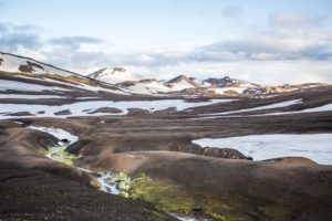
The next step begins quite easily by following the path along the valley, juggling between snow, black gravel and geothermal springs living a trail of deep green moss in their wake, quite an unsettling sight in this dark environment. Be careful, snow slabs can sometimes cover the path and render the descents and ascents into the terrain irregularities a little acrobatic.
After a few kilometers, you will notice the Háskerðingur on your left, a relatively easy mountain to climb if you leave your backpack at the bottom. There is no trail per se but the climb, not that a challenge, should take you to the top under half an hour and offer you a pretty nice view of the surroundings.
As you carry on, you will soon reach the end plateau’s end and be able to see a lake faaaar below where the Álftavatn refuge is located. But before reaching it, you will now have to deal with a very nasty slope and its knee-breaking pathways. Walking sticks have been of great help to me in this passage, and if you are suffering, comfort yourself with the faces of the poor hikers passing you by, climbing their way up on this never-ending path. I know it’s petty, but it feels good nonetheless.
Once you’ve reached flat ground once again, you will gladly discover that grass exists on this goddamn island, as well as some rivers. Wide and cold rivers. Incidentally, it is now time for your first water crossing! Since I am an idiot, I decided not to bring sandals in order to gain some backpack weight, and boy did I regretted that choice. The water temperature will still be ice cold, but without those kind of shoes, the instable bottom gravel will be more than happy to slide under your feet right where it hurts, with no help from your backpack weight. Without walking sticks, a slip is almost certain.
The last part consists of a charming little greenish path leading you to the lake and the Álftavatn refuge, slightly bigger that the previous one. Contrary to Hrafntinnusker where the tent sites were nice and well spaced, here it is a battle for flat and stable ground. Since many people come here directly from Landmannalaugar, it is also way more crowded. Get your earplugs ready and you may not hear Piotr complaining about the smell of Svetlana socks for an hour.
For the record, there is another shelter three kilometers away, Hvanngil. More intimate, I think that this one doesn’t allow camping so booking is required, but it would be worth a double check.
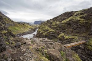
Well, no time to warm your toes, the first fording site is barely 500m away. Same mumbo jumbo as before, remember to tightly tie your shoes to your bag, high enough so that they don’t reach the water. Yes it’s obvious, and yes it comes from experience. After passing Hvanngil, the path leads you to a first bridge crossing a river, then another ford where you will have to get your feet wet once again. A little less deep but much wider than the previous one, beware of invisible holes in the water, they are treacherous.
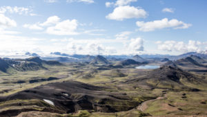
From there, get ready to walk several kilometers in Mordor as the path leads you into a sandur, a sandy plain formed by glacial alluvium, surrounded by mountains as black as Mitch McConnel soul. This section is as beautiful as it is looooong. At least, the path is easy to follow and will eventually lead you to a small pass opening onto a slightly more hilly landscape where, after the final kilometers, Emstrur’s refuge will appear down below.
This refuge camping area offers well defined spots near a cute and small river. Once you dropped your gear, and weather permitting, it is time to a short three kilometers loop that will take you to one of the hike’s most beautiful landscape: the Markarfljótsgljúfur canyon.
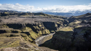
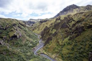
This pretty little walk starting 500m away from the refuge towards Álftavatn offers you to admire a daunting 200m deep canyon, the path being literally delimited by cliffs. Possible picnic stops are numerous, and the vantage points are simply amazing. I hiked this part in the afternoon and despite the midnight sun, the canyon was largely in the shade. For photo enthusiasts, the morning light might be more suitable. Plan for a wide angle, it’s worth a shot (haha).
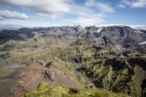
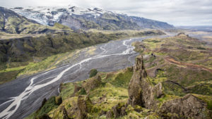
To the south, you’ll notice a glacier plateau on the left and the canyon widening into a small winding valley towards Þórsmörk. Keep this view in mind; this is tomorrow’s route.
Get ready to roll, the path begins with a fairly steep drop, a bridge over a roaring river and the crossing of the plateau seen the day before. After a last short climb, you are now on the track following the aforementioned river from above almost until the end. Nothing specific to report on that lovely, but quite monotonous part if I have to be honest. About four kilometers before Þórsmörk, you will come across the last ford, and oh boy did they keep the worse one for the end. Hang tight, this is a strong one with multiple sections and a rather opaque water easily covering underwater traps. After reaching the other side, the landscape gradually becomes greener and greener as the stunted shrubs slowly turns into trees. Well… Icelandic trees, don’t expect centuries old oaks, but you are now located in one of the rare “forested” areas of the island, included in the 1,4% total wooded territory of Iceland.
Before the Viking era, Iceland was very green with forests covering 30% of its territory at the time, but the first settlers started a massive deforestation allowing colonization. As the cattle grazed the small plants holding everything together, erosion increased exponentially, giving birth to the moonish landscape we know today. Nevertheless, reforestation initiatives have developed well over the past century, and Iceland is now slowly growing its leaves back.
This gardener parenthesis was there to introduce you to the fact that finding your way around Þórsmörk might prove a tad tricky as the trees along the path can block the view. There are three campsites in the area so follow closely the signs to the chosen one. Having to cut through the bushes to find your way and finishing impaled on a pubescent birch tree is not the classiest way to go.
Speaking of the devils, let’s talk about campsites. Three choices are available depending on your future plans:
-
Volcano Huts: Big, classy, friendly with a neat small restaurant and a nice lawn to pitch the tent, this is the closest campsite to the road (even if busses still go up to Básar) and may be the ideal stop if your hike ends here and/or you are in a rush and die to warm your extremities at Blue Lagoon. It can also be a nice stop on your way to Skógar to fill your belly with homemade food in a large wooden cabin (and try the barrel shaped sauna) but then beware, it will add four kilometers to the already 25 kilometers long last part.
-
Básar campsite: Small, cute with a mini-shop at the reception, the tent area is wilder and you can set up camp under the trees. This is the perfect spot to start your walk to Skógar in peace.
-
Langidalur campsite: Pocket camp site right between the other two, which can be a good compromise.
Whatever you choose, do not miss the short hike from Volcano Huts to Langidalur via the Valahnúksból summit. Once up there, the view is a 240° wide panorama over black glaciation tributaries surrounded by emerald green mountains. This is THE landscape you should not miss.
This last part is quite specific. First, this is the longest, although you can split it in half by stopping at the Fimmvoruhals refuge. Beware, the area up there is very exposed and camping can be difficult on a very rough ground. The best option is to book a bed, but you will have to do that well in advance as space is seriously limited. Secondly, if the walk between Básar and Fimmvoruhals is a treat for the eyes, the last 15 kilometers to Skógar might seems a little duller, leaving the amazing landscapes behind you on a never-ending walk. Still punctuated with no less than 26 waterfalls, which is always nice, it is, nonetheless, not the pinnacle of the journey.
Personally, I was planning to finish hiking in Skógar, but my knees were starting to scream in pain (too heavy backpack, a classic) so I decided to drop all the unnecessary stuff in Básar before walking back and forth between the campsite and Fimmvoruhals with a lightweight bag. I left the day after to Reykjavik without needing to amputate both of my legs.
From Básar, the journey starts calmly along the glaciation tributary before climbing under the vegetation. You will leave the trees behind you fairly quickly and if you remember to turn around, you will already be able to contemplate Þórsmörk down in the valley. After your first clear view of Mýrdalsjökull glacier, now is the time to engage to first real ascent that leads on a huge rocky plateau where the path continues for a few kilometers before gaining altitude again on a steep slope. Be careful here, the view is as beautiful as the pebbles are deceitful. Not the best place to break leg. Once this trial is passed, the daring hiker is rewarded with the Eyjafjallajökull lava field, the very traces of the 2010 eruption that disrupted the entire European air traffic for several weeks. You tell them volcano !
Your butt is now seating on Godaland’s plateau, between the Eyjafjallajökull and Mýrdalsjökull glaciers. On your right, you will cross the Magni and Móði craters, which appeared during the infamous eruption. It is possible to climb them in order to enjoy a 360° view over a large part of the region.
If you feel like it, and have some energy left after this 1000 meters elevation gain, you can then walk the last few kilometers to the Fimmvoruhals refuge, the perfect place for a snack. On your way back, you can either follow the same path or a variation that will take you closer to the Volcano Huts campsite, but the marking is much less visible outside the usual paths, so don’t be a fool.
CONCLUSION
Here finishes my tale. I will not dwell much into the practical details since all the relevant informations regarding accommodation and transport are easily accessed in two clicks over the Internet. As for the gear, nothing out of the ordinary for few days hike in autonomy, except sandals and walking sticks (those pointy things are life savers).
The weather has been incredibly mild during my hike, but it is far from always the case, so a few waterproof overlays are mandatory. It is also fairly easy to go there on a budget by only using the refuges to camp and bringing your own food. For water, a sturdy camelback will do the trick as you can either refill in the refuges or the rivers. No need to boil it, the water is of excellent quality. However, orientation is crucial. Even if the markings are clear, it is better to know where you are and where you are heading when conditions deteriorate. GPS is not necessarily mandatory, although refuge guards can block the hikers who do not have one in case of heavy fog, but a detailed map is the minimum (buyable in every Reykjavik tourist offices).
That’s it, you now know everything. Just remember, as for everywhere, be a nice chap! The Laugavegur is a very popular hike in Iceland, and even if the environment looks pretty dead, it remains fragile. Collect all your garbage as it does not biodegrade in these temperatures, be nice to the locals who can sometimes come as little rough on the edges (but still soft in the inside. That’s Scandinavian hospitality for you) as well as with your fellow hikers and everything will go well.
Over and out.
